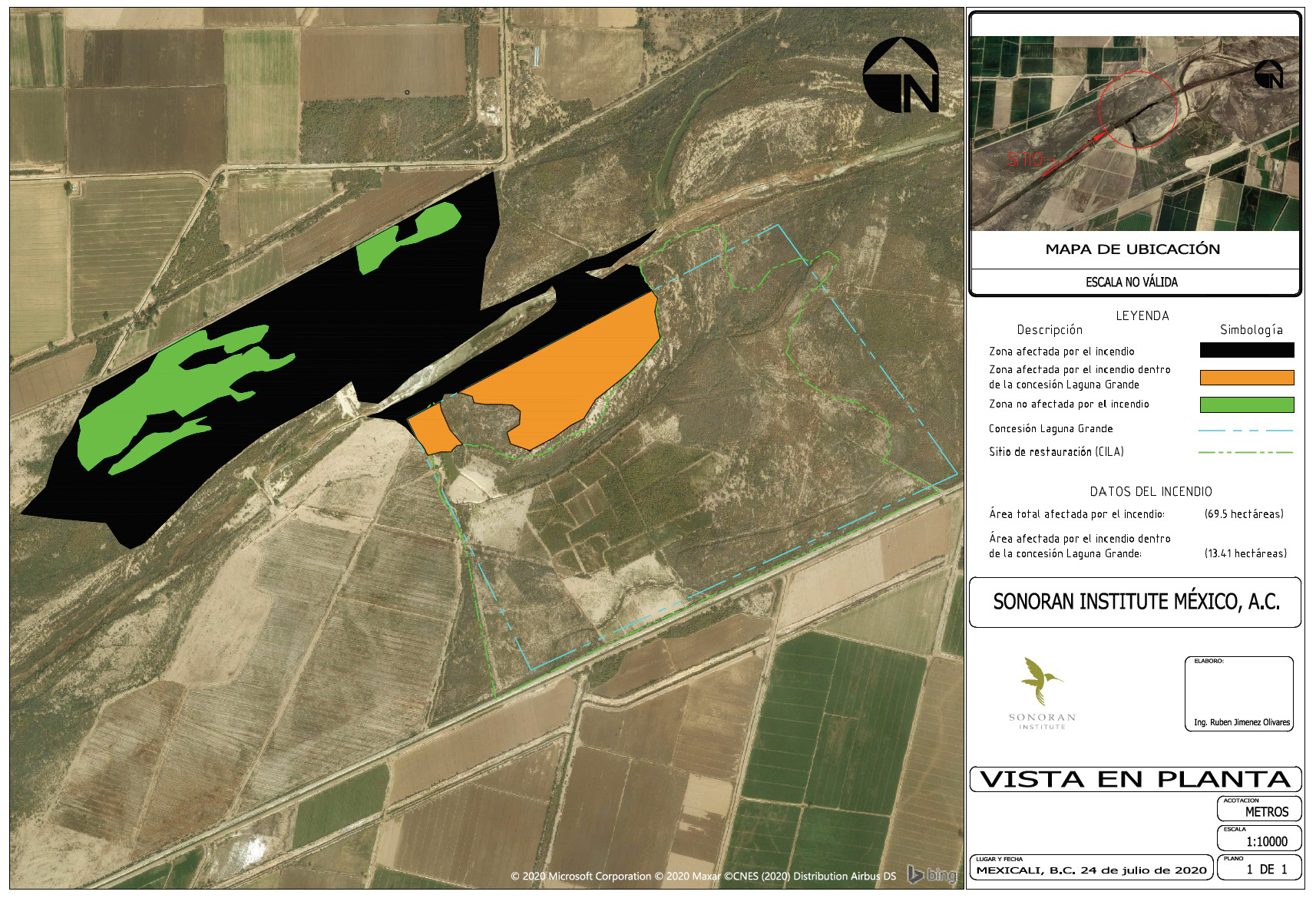
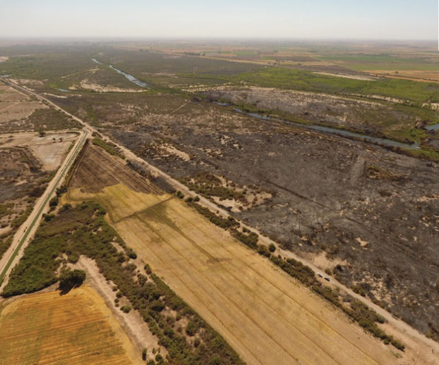
On July 19 and 20, 2020 fires broke out near our restoration site in the Delta. It is unknown how the fires began. Nearly 172 acres were affected, 33 of which are within the Laguna Grande land concession where we have been restoring habitat, caring for the land, and stewarding the river for over a decade. Most of the land affected is adjacent to the areas we have planted with native tress and shrubs, just on the opposite side of the river meander.
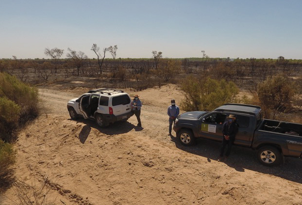
After the fires were safely out, Deus Dedit, GIS technician and Rubén Jiménez, coordinator of engineering projects, carried out a drone flight to measure the area affected by the fires. We are thankful that none of the trees we have planted and none of our restored acreage were lost.
We are grateful to the dedication of our team members who courageously fought the fires to prevent damage to our restoration site, kept one another safe, and demonstrated deep commitment to the Colorado River delta.
Timeline of events:
Sunday, July 19
Fire sighted. 2 p.m. Edgar Flores, field assistant, called in an alert about the fire.
Mobilizing staff. 2:05 p.m. Rocío Torres, director of Sonoran Institute Mexico gives the call in for staff emergency team. Sonoran Institute called 9-1-1.
Securing firefighting support. Edith Santiago, program director, contacted the head of Community Forest Management and Forest Restoration National Commission (at the federal government). Because Mexicali is registered as an agricultural and non-forest area, there is no fire service team in the Municipality, and we were connected to the head of the Department of Civil Protection from the Ministry of Field and Food Security of Baja California to request support from firefighters. Their brigade was attending a fire near La Rumorosa Mountain but spoke to Civil Protection who attended to priority inhabited areas: ranches, communities and ejidos near the fire.
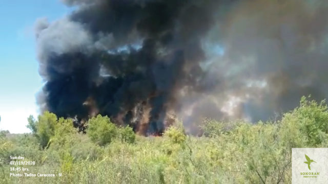
Reconnaissance. 2:45 p.m. Tadeo Caracoza, hydraulic technician, arrives to take coordinates, films video and assesses routes that are safe by vehicle. With data from Tadeo, Rubén Jiménez obtained wind projections and anticipated that fire was headed directly to the restoration site.
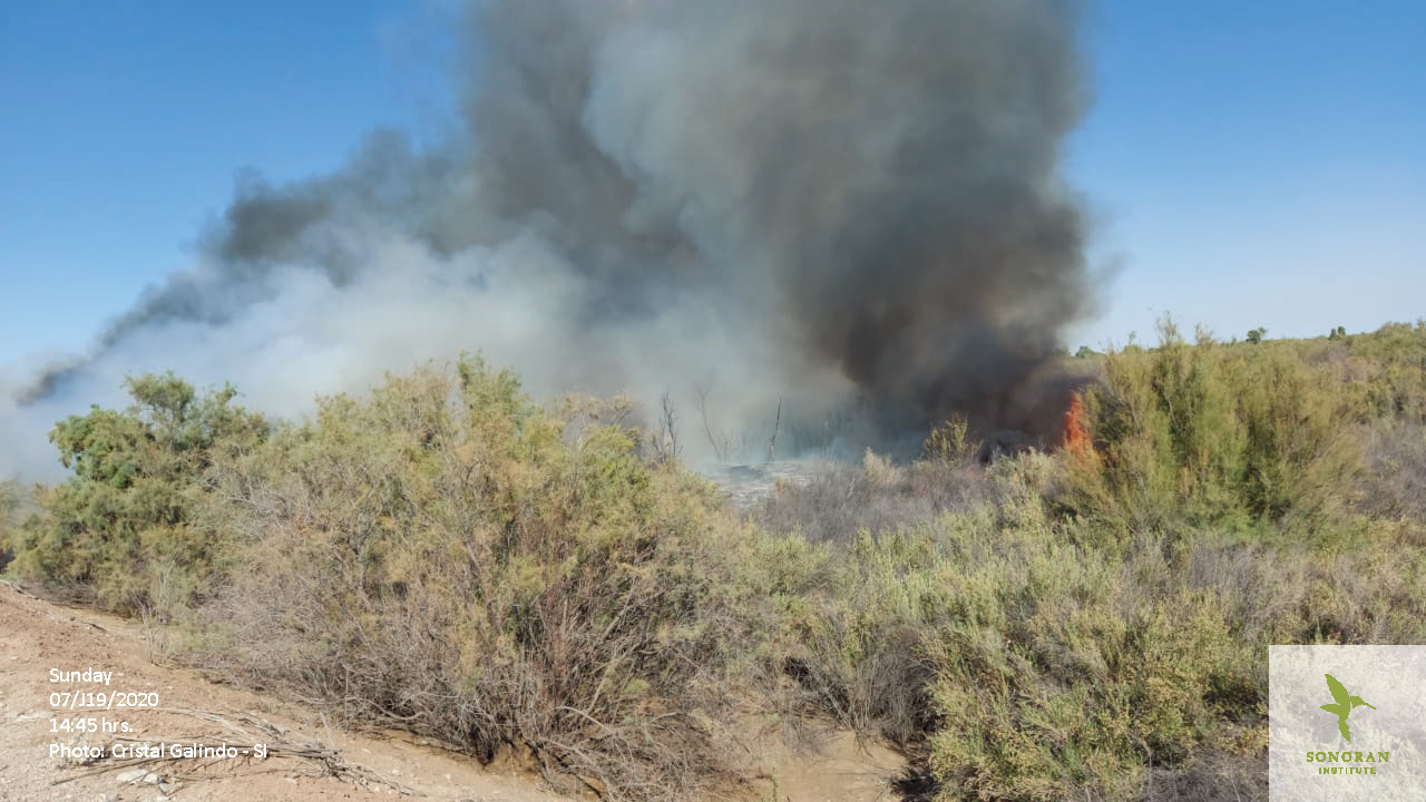
Fire approaches restoration site. 7 p.m. Guadalupe Fonseca, chief of field team, confirms fire approaching. Five people from our field team, Guadalupe Fonseca, Edgar Flores, Cristal Galindo, Enrique Rosas and José Luis Cabrera, prepare to create fire breaks and contain the fire in CILA. Also, three volunteers from the community joined to help: Israel Oceguera Gamiño and his sons, Nathaniel and José Israel Oceguera Merin. (Total: 8 people.)
Fire gains strength. 8 p.m. The fire jumps the river and reaches the lagoon, in front of Laguna Grande Interpretive Center. Firefighters in the area were unable to directly assist our site because they were attending fires closer to the inhabited communities.
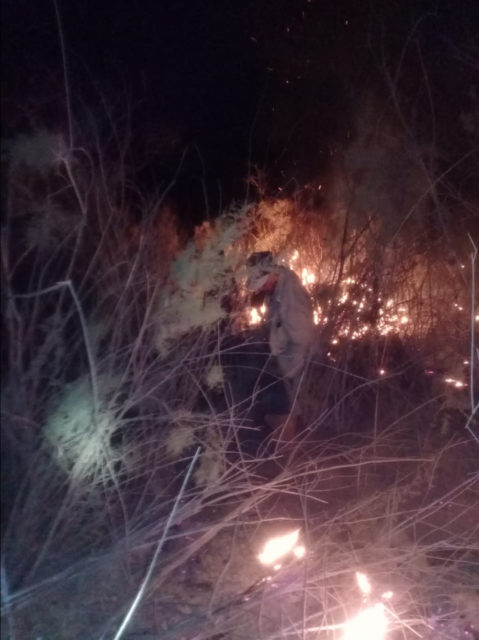
Fire under control. At 10 p.m. the field team reports that the hard work of shoveling dirt and sand over new sparks to maintain fire breaks has successfully gained control over the fire, preventing further spread.
Fire out. Midnight. The field team reports to Rocío Torres that the emergency work is complete and three colleagues and the three volunteers are retiring to their homes safely.
Overnight watch. Guadalupe Fonseca and Edgar Flores, from the field team, stayed to keep watch at the restoration site all night, without a fire occurring again.
Monday July 20
New fire. 1 p.m. Cristal Galindo, field supervisor informs the Sonoran Institute emergency team about another fire near the restoration site (CILA).
Mobilizing. 1:15 p.m. emergency team convenes to set strategies that will help minimize fire coverage.
Another fire. 2 p.m. Tadeo Caracoza reports another very intense fire near the restoration site, however the wind was not as concerning as the day before—reduced speed and headed in different direction.
Under Control. 3 p.m. Cristal Galindo reports that the fire intensity decreased, and firefighters controlled the fires.
Tuesday, July 21
Survey damage. 8 a.m. Deus Dedit (GIS Technician) and Rubén Jiménez (Coordinator of Engineering Projects) used a drone to help quantify the area affected by the fires.
Blog post by: Rocío Torres, Mexicali office director